The 1996 season was a very active season due to a continuing La Nina, although ENSO conditions changed to Neutral by the Middle of October. 1996 also was the second year in the active phase which started in 1995 to present. Furthermore, the 1996 season had 4 destructive hurricanes Cesar, Fran, Hortense, and Lili. Frand was the most destructive of the 4, so this thread is going to be about Hurricane Fran.
A tropical wave moved off the coast of Africa on August 22nd. Computer models started to show this wave becoming a hurricane in the next several days. Satellite data indicated the wave was already well developed but lacked a closed circulation. On August 23rd a closed circulation developed and the wave was declared a tropical depression.
Despite warm water the larger and more powerful Hurricane Edouard to the east caused up welling and wind shear. This prevented the depression from developing for the next few days. As Edouard moved away the depression began to tap into the favorable environment. On August 27th the depression's winds increased to 50 mph and it was given the name Fran. Fran would steadily strengthen over the next few days.
On August 29th Fran became a category 1 hurricane with winds up to 75 mph. On the 30th interaction from Edouard which was now northward of Fran caused Fran to briefly weaken back to a tropical storm. On August 31st Fran's winds increased to 80 mph making it a hurricane again. On September 1st Fran wind's increased to 90 mph making it a high end category 1 hurricane.
September 2nd Fran's eye wall began to tighten and the hurricane was noted of rapidly becoming better organized. The winds in Fran increased to 105 mph making Fran a category 2 hurricane. The National Hurricane Center forecasted Fran to become a major hurricane. The models started to agree that Fran would make landfall between Myrtle Beach SC and Cape Hatteras North Carolina.
On September the 3rd Fran became a category 3 hurricane with winds up to 115 mph making Fran a major hurricane. On September 4th Fran reached its peak with winds up to 120 mph and a pressure of 946 millibars. By this time Fran had become a very large hurricane over the Gulf Stream which meant Fran was having to pull up a lot of water to ventilate. Fran's speed picked up as it headed toward the Carolinas. The forward speed kept Fran from ramping up more.
On September 5th Fran made landfall at Cape Fear North Carolina at peak strength with winds 120 mph. After moving inland Fran moved into North Carolina and eventually Virginia. Eventually the remnants of Fran moved back over water on September 8th but the water it moved over was cool. Thus Fran transitioned into an extra tropical cyclone.
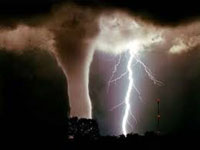
Fran produced a high storm surge of 10 feet when it came ashore in North Carolina. Also Fran's 115-120 mph winds caused severe damage. As Fran moved inland severe flooding occurred in North Carolina, Virginia and even parts of West Virginia. In addition, to the flooding, wind, and storm surge Fran is believed to have produced up to 60 tornadoes in South/North Carolina, Virginia and even West Virginia.
Overall, Fran claimed 27 lives and caused $5 Billion in damages. At that time Fran was one of the top 10 costliest hurricanes although it has been passed by more destructive hurricanes. Due to the severe impacts in the Carolinas the name Fran was retired the following year and replaced with the name Fay on the naming list.
Fran was the most destructive hurricane from the 1996 season in terms of cost. It was also the 2nd of 4 destructive hurricanes from that year. Hurricane Fran also started a trend of destructive North Carolina Hurricanes over the next few years. 3 years later Hurricane Floyd produced similar results to a state that was still recovering from the impacts of Fran.
Even though Hurricane Fran has been 29 years ago this hurricane is still talked about to this day. As a meteorologist Fran started a trend of very large hurricanes. While there was large hurricanes before 1995 Hurricanes Betsy, David, Allen, Gilbert, and Hugo come to mind, 1995 started a trend of storms being bigger and leading to more impacts.
The 1996 season was a very active season due to a continuing La Nina, although ENSO conditions changed to Neutral by the Middle of October. 1996 also was the second year in the active phase which started in 1995 to present. Furthermore, the 1996 season had 4 destructive hurricanes Cesar, Fran, Hortense, and Lili. Frand was the most destructive of the 4, so this thread is going to be about Hurricane Fran.
A tropical wave moved off the coast of Africa on August 22nd. Computer models started to show this wave becoming a hurricane in the next several days. Satellite data indicated the wave was already well developed but lacked a closed circulation. On August 23rd a closed circulation developed and the wave was declared a tropical depression.
Despite warm water the larger and more powerful Hurricane Edouard to the east caused up welling and wind shear. This prevented the depression from developing for the next few days. As Edouard moved away the depression began to tap into the favorable environment. On August 27th the depression's winds increased to 50 mph and it was given the name Fran. Fran would steadily strengthen over the next few days.
On August 29th Fran became a category 1 hurricane with winds up to 75 mph. On the 30th interaction from Edouard which was now northward of Fran caused Fran to briefly weaken back to a tropical storm. On August 31st Fran's winds increased to 80 mph making it a hurricane again. On September 1st Fran wind's increased to 90 mph making it a high end category 1 hurricane.
September 2nd Fran's eye wall began to tighten and the hurricane was noted of rapidly becoming better organized. The winds in Fran increased to 105 mph making Fran a category 2 hurricane. The National Hurricane Center forecasted Fran to become a major hurricane. The models started to agree that Fran would make landfall between Myrtle Beach SC and Cape Hatteras North Carolina.
On September the 3rd Fran became a category 3 hurricane with winds up to 115 mph making Fran a major hurricane. On September 4th Fran reached its peak with winds up to 120 mph and a pressure of 946 millibars. By this time Fran had become a very large hurricane over the Gulf Stream which meant Fran was having to pull up a lot of water to ventilate. Fran's speed picked up as it headed toward the Carolinas. The forward speed kept Fran from ramping up more.
On September 5th Fran made landfall at Cape Fear North Carolina at peak strength with winds 120 mph. After moving inland Fran moved into North Carolina and eventually Virginia. Eventually the remnants of Fran moved back over water on September 8th but the water it moved over was cool. Thus Fran transitioned into an extra tropical cyclone.
Fran produced a high storm surge of 10 feet when it came ashore in North Carolina. Also Fran's 115-120 mph winds caused severe damage. As Fran moved inland severe flooding occurred in North Carolina, Virginia and even parts of West Virginia. In addition, to the flooding, wind, and storm surge Fran is believed to have produced up to 60 tornadoes in South/North Carolina, Virginia and even West Virginia.
Overall, Fran claimed 27 lives and caused $5 Billion in damages. At that time Fran was one of the top 10 costliest hurricanes although it has been passed by more destructive hurricanes. Due to the severe impacts in the Carolinas the name Fran was retired the following year and replaced with the name Fay on the naming list.
Fran was the most destructive hurricane from the 1996 season in terms of cost. It was also the 2nd of 4 destructive hurricanes from that year. Hurricane Fran also started a trend of destructive North Carolina Hurricanes over the next few years. 3 years later Hurricane Floyd produced similar results to a state that was still recovering from the impacts of Fran.
Even though Hurricane Fran has been 29 years ago this hurricane is still talked about to this day. As a meteorologist Fran started a trend of very large hurricanes. While there was large hurricanes before 1995 Hurricanes Betsy, David, Allen, Gilbert, and Hugo come to mind, 1995 started a trend of storms being bigger and leading to more impacts.
--------------------


 User Notice